Disaster in Vietnam: A glance from international disaster dataset GDIS
How is the overview of disaster in Vietnam in a long period? Geocoded Disasters (GDIS) Dataset (1960 – 2018) from Socioeconomic Data and Applications Center (SEDAC) helps to shed the light on this question.
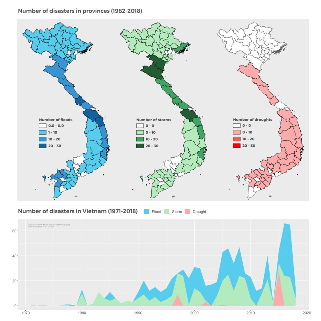
From the overall perspective, the disaster statistics in the period of 1982-2018 in Vietnam are dominated by floods and storms., mostly concentrated in the North and Central regions. Even though drought is frequently occurred in the South, the Central region suffered the most from disasters
Alarmingly, the frequency of disasters has been increasing over time. The period of 2016-2017 witnessed a series of disastrous floods, storms and droughts.
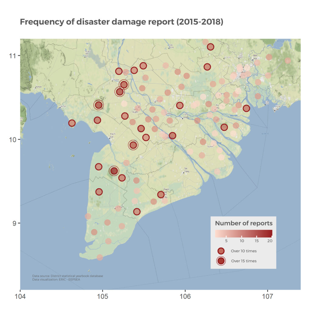
The nationwide suffer from disasters, especially storms and floods, could be explained by the natural topography of sea’s proximity and rivers’ systems. Disaster damage statistics in Mekong Delta region, which is reported from district statistical yearbooks, show the case somehow. The districts which are near major rivers reported disaster damage in higher frequency in the 2015-2018 period.